
Puy-le-Haut > Les Cours, Auris
Medium
2h30min
6.2km
Loop
+215m
-215m
Description
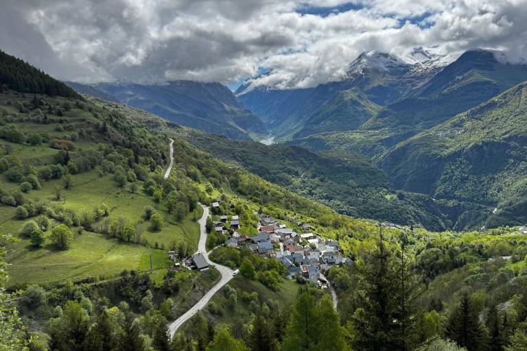
The Postman's Trail is an easy path that winds through the meadows, offering a peaceful, pastoral experience. You'll walk past the smooth rocks characteristic of the local geology, as well as the Trévoux Cross.
Trace the history of the Postman’s Trail with a stroll through the meadows. You’ll enjoy breathtaking views of the Romanche River and the Écrins Massif, dominated by the Meije.
TECHNICAL INFORMATION
Start: Les Cours, Auris-en-Oisans
Elevation gain: 215 m
Loop duration: 2.5 hours
Distance: 6.2 km
MAP AND GUIDE
IGN Top 25 Bourg d'Oisans and l'Alpe d'Huez 3335 ET
OBP Guidebook No. 3, Trails 315+314+310
ITINERARY
Park at the Cours parking lot, cross the village toward La Mine following the yellow sign (former Freney-d’Oisans ore mine), then follow the road until you reach the trail on your right, which will take you to Puy-le-Haut (yellow sign: Lauzas). Continue on this trail toward Puy-le-Haut.
- Once you arrive at Puy-le-Haut, retrace your steps, following the yellow sign for Lauzas-le-Haut. Finally, follow the Lauzas-le-bas path, which will lead you to the postman’s path marked Les Cours/Le Chemin du Facteur. The trail passes through a shadier area before crossing to the other side of the more open valley to Les Cours.
SIGHTS ALONG THE ROUTE
- The Croix de Trévoux (Trévoux means “three paths”), a site at the crossroads of three paths where the municipalities of Freney-d’Oisans and Auris-en-Oisans meet
NEARBY ATTRACTIONS AND ACTIVITIES
- the heritage orientation trail, exploring the hamlets of Auris-en-Oisans (available at the tourist office or downloadable from www.auris.fr).
GOOD TO KNOW
The Les Cours / Puy-le-Haut hike is called the Postman’s Trail, as for a very long time, the postman used this path to deliver the mail.
Dogs must be kept on a leash due to the presence of herding dogs at certain times of the year.
Marking
Map references
IGN TOP 25 3335 AND
